Point Cloud Survey
Advanced 3D laser scanning and photogrammetry for accurate spatial data capture and BIM modelling.
What is Point Cloud Survey?
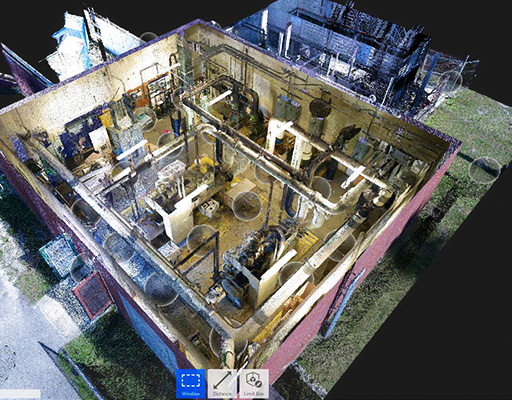
A point cloud survey is an advanced method of spatial data capture that uses 3D laser scanning (LiDAR) or photogrammetry to collect millions of data points from a physical space or object. These data points create a highly accurate digital representation of the surveyed environment.
Our point cloud survey services provide precise, high-resolution data that serves as the foundation for BIM modelling, renovation projects, and detailed analysis. We use state-of-the-art laser scanning technology to capture complex geometries with millimeter-level accuracy.
Key Benefits
- Millimeter-level accuracy for precise measurements
- Rapid data capture of complex environments
- Non-invasive scanning with minimal disruption
- Foundation for accurate BIM model creation
- Versatile data for multiple applications
Our Point Cloud Survey Services
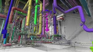
3D Laser Scanning
High-precision LiDAR scanning to capture detailed spatial data from buildings and environments.
Photogrammetry
Advanced photographic techniques to create detailed 3D models from multiple image perspectives.
Data Processing
Advanced processing and registration of point cloud data for clean, usable datasets.
BIM Integration
Seamless integration of point cloud data into BIM workflows and modelling software.
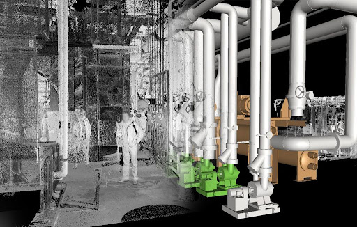
As-Built Documentation
Accurate as-built drawings and documentation from scanned point cloud data.
Multiple Formats
Delivery in various formats including LAS, E57, PTS, and BIM-compatible files.
Capture Accurate Spatial Data Today
Contact us to discuss how our point cloud survey services can provide the foundation for your next project.
Get Started